Wingertshäusje Leutesdorf

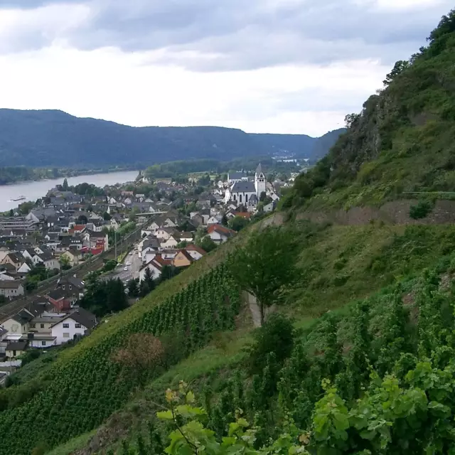
The Wingertshäusje in Leutesdorf is located right on the steep slopes of the Andernacher Pforte – the narrow point of the valley where the Rhine, flowing from the Neuwied Basin, bursts through the rocks and wends its way north.
Facts
-
9,2 km
Distance
-
2,75 hours
Duration
-
medium
Difficulty level
The Wingertshäusje in Leutesdorf is located right on the steep slopes of the Andernacher Pforte – the narrow point of the valley where the Rhine, flowing from the Neuwied Basin, bursts through the rocks and wends its way north.
Few other places showcase the typical Middle Rhine landscape in as concentrated a form as the Best Vineyard View in the Mittelrhein Region for 2012.
Leutesdorf, for example, with its steep slopes of reallocated land, stands in stark contrast to the old terraced vineyards with its drystone walls. And the solid rock formations provide an indication as to how little soil pile-up there is in the vineyards directly below – a peculiarity reflecting the unique style of the Mittelrhein Rieslings.
To the left on the horizon is the „Hohe Buche“ volcano in the Eifel Mountains, and to the right is the “Loreley of the North,” the Hammerstein ruins on their mighty rock massif, which ends in an almost sheer vertical drop down into the Rhine.


